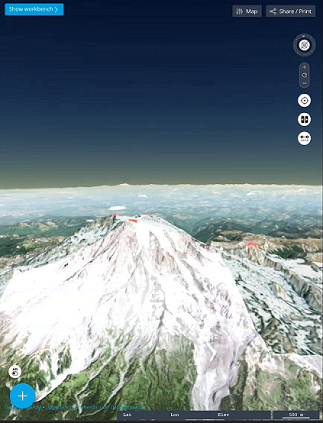
Earth Explorer 3D Map app is an augmented Reality Map app that
works online connected and offline.
Earth Explorer 3D Map app is a Native iOS and Android mobile
application that works on phone and tablets the app opens with a 3D
Globe rich immersive mapping application as the main screen and has a
button
3D Terrain Views
The app supports for OGC 3DTiles (Batched 3D Model
(b3dm),Instanced 3D Model (i3dm)) and also supports gltf/glb 3D
Models
Augmented Reality
The app supports device sensors accelerometer, gyroscope,
compass & GNSS to support controlling view of the map
Load Map Catalogs JSON
The Integrated Catalog Creator/Editor Tool allows you to build a
JSON MapCatalog that has pre-loaded Map Services.
Load Tiles
The app supports for offline vector tiles mbtiles (vector tiles
lines and polygon only) and also supports raster tiles from
(mbtiles and gpkg).